
Mgrs & Utm Map Pro

Mgrs & Utm Map Pro
DakikTech
MOD Features
App Information
About Mgrs & Utm Map Pro
The creators of Mgrs & Utm Map Pro aimed to develop an app tailored to the needs of military personnel, mountaineers, trekkers, hikers, runners, geocachers, hunters, and anyone who loves outdoor exploration. With its wide array of features, this app is essential for enthusiasts of outdoor activities.
 |
 |
ACCESS TO A VARIETY OF MAPS ENHANCES THE EXPLORATION OF DIVERSE ENVIRONMENTS
One of the standout features of Mgrs & Utm Map Pro is its access to a variety of maps. Options such as Bicycle, Topographic, Neighborhood, and Atlas maps allow users to navigate different terrains, including mountains, forests, and deserts. This feature assists users in planning their routes and discovering new locations.
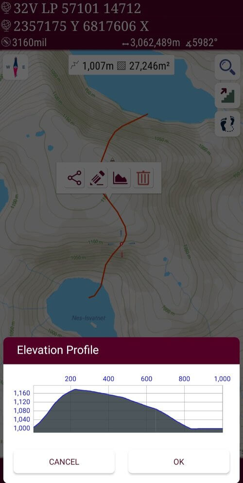
AN ALTITUDE PROFILE CHART AIDS IN MONITORING ELEVATION CHANGES FOR OUTDOOR ENTHUSIASTS
A unique aspect of this app is the ability to view the altitude profile of the user's route in chart form. This feature is invaluable for those engaged in outdoor pursuits like hiking, trekking, or mountaineering, enabling them to track altitude changes. Users gain a comprehensive understanding of the landscape and physical demands of the route, allowing for better planning of their activities.
ADDRESS-BASED SEARCH SIMPLIFIES FINDING DESIRED DESTINATIONS
With Mgrs & Utm Map Pro, users can perform address-based searches to locate destinations. This feature simplifies the process of finding a desired location without manual map navigation. The search functionality allows users to quickly find locations and access driving directions.
 |
 |
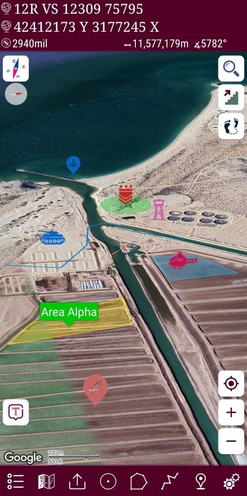
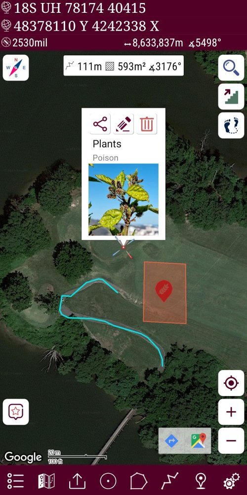
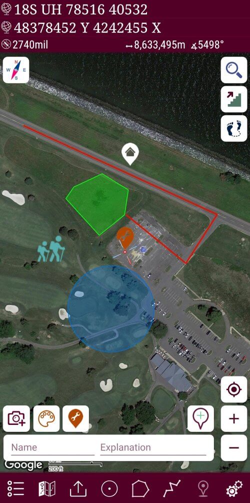
ORGANIZE ACTIVITIES INTO MULTIPLE LAYERS FOR STREAMLINED NAVIGATION
Mgrs & Utm Map Pro offers the ability to create distinct layers for various activities. This feature facilitates managing and navigating multiple locations by allowing users to categorize their activities. Users can layer activities such as hiking, fishing, hunting, and more, enhancing the overall app experience with a personalized approach to navigation.
MANAGE MARKERS, ROUTES, AREAS, AND KML WITH A LIST VIEW
The app also provides a list view for areas, routes, markers, and KML, simplifying the management and monitoring of these elements. Users can add and remove markers, measure areas and distances, and customize colors for different areas and routes.
ENHANCED MAP VISIBILITY WITH POINTER ICONS
Installation Guide
More in maps & navigation


You May Also Like
More


